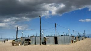

There’s little reliable data on local incomes in developing countries, which hampers efforts to tackle the problem.
A team from Stanford University were able to train a computer system to identify impoverished areas from satellite and survey data in five African countries.
“We traditionally collect poverty data through household surveys… we send survey enumerators around to houses and we ask lots of questions about income, consumption – what they’ve bought in the last year – and we use that data to construct our poverty measures.”
However, surveys are costly, infrequent and sometimes impossible to carry out in particular regions of countries because of, for example, armed conflict.
So there is a need for other accurate measures of household consumption and income in the developing world
I – Word Understanding
Hampers – slows down
Impoverished – poor
Survey enumerator – a person in charge of a survey (help participants answer questionnaires)
II – Have Your Say
1. What is poverty?
2. What issues on global poverty are you aware of?
3. What issues on poverty do you have in your country?
4. Why is it important to gather as much data/information on poverty? How can it help?
5. How do you think we can identify poverty using satellite images? What are the useful signs?
6. Do you think that the rich are getting richer and the poor are getting poorer?